Nous vous proposons une sortie emblématique de la région lémanique : les Rochers de Naye.
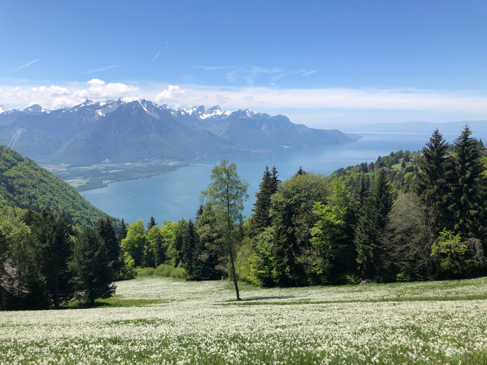
Grimpant à 2042 mètres d’altitude, cette randonnée traverse champs et forêts, et nous mène aux Rochers-de-Naye, au-dessus de Montreux. Avec l’augmentation de l’altitude, le chemin longe la pente et offre des vues toujours plus spectaculaires sur le lac Léman et les montagnes environnantes. Au sommet, nous aurons accès au Parc de la Marmotte et au jardin botanique alpin de la Rambertia avec plus de 800 plantes de montagne du monde entier.
La randonnée est facile au départ et devient un peu plus difficile vers la fin, où nous serons sur un sentier de randonnée de montagne. La toute dernière partie (15 dernières minutes) peut être un peu glissante, raison pour laquelle nous vous conseillons donc de bonnes chaussures de marche ou de montagne.
- https://www.myswitzerland.com/fr-ch/decouvrir/rochers-de-naye/
- https://www.schweizmobil.ch/fr/hiking-in-switzerland/etappe-01552.html (nous ferons juste une partie de cette randonnée).
Pour redescendre, vous pourrez choisir deux options : prendre le train (il y a une gare au sommet de la montagne) ou redescendre à pied :
- Option 1 : Aller à pied – retour à pied (5-6 heures)
- Option 2: Retour en train (3 heures)
- Date : Dimanche 19 juin 2022
- Départ : 10h45 (Gare CFF de Caux)
- Arrivée : 17h (Caux, si retour à pied)
- Arrivée : 15h (Caux, si retour en train)
- Technique : Sentier de randonnée
- Difficulté sentier : moyenne
- Difficulté fitness : moyenne
Pour vous inscrire ou pour toute question spécifique, n’hésitez pas à envoyer un message à gayhikinggva@gmail.com.
English
An iconic hike in the Lake Geneva region: the Rochers de Naye.
Climbing to an altitude of 2042 meters, this hike crosses fields and forests, and leads us to the Rochers-de-Naye, above Montreux. As the altitude increases, the path skirts the slope and offers ever more spectacular views of Lake Geneva and the surrounding mountains. At the top, we will have access to the Marmot Park and the Rambertia Alpine Botanical Garden with over 800 mountain plants from around the world.
The hike is easy at the beginning and gets a little more challenging towards the end, where we will be on a mountain hiking trail. The very last part (last 15 minutes) can be a bit slippery, so we recommend well-trained hiking or mountain boots.
- https://www.myswitzerland.com/fr-ch/decouvrir/rochers-de-naye/
- https://www.schweizmobil.ch/fr/hiking-in-switzerland/etappe-01552.html (we’ll be doing just part of this hike).
To get back down, you’ll have two options: take the train (there’s a station at the top of the mountain) or walk back down:
- Option 1: Walk up – walk back down (5-6 hours)
- Option 2: Return by train (3 hours)
- Date: Sunday, June 19, 2022
- Departure: 10:45 am (Caux SBB Station)
- Arrival: 5 pm (Caux SBB Station, if returning on foot)
- Arrival: 3 pm (Caux SBB Station, if returning by train)
Technique: Hiking trail
Trail difficulty: medium
Fitness difficulty: medium
To register or for specific questions, feel free to send a message to gayhikinggva@gmail.com.
